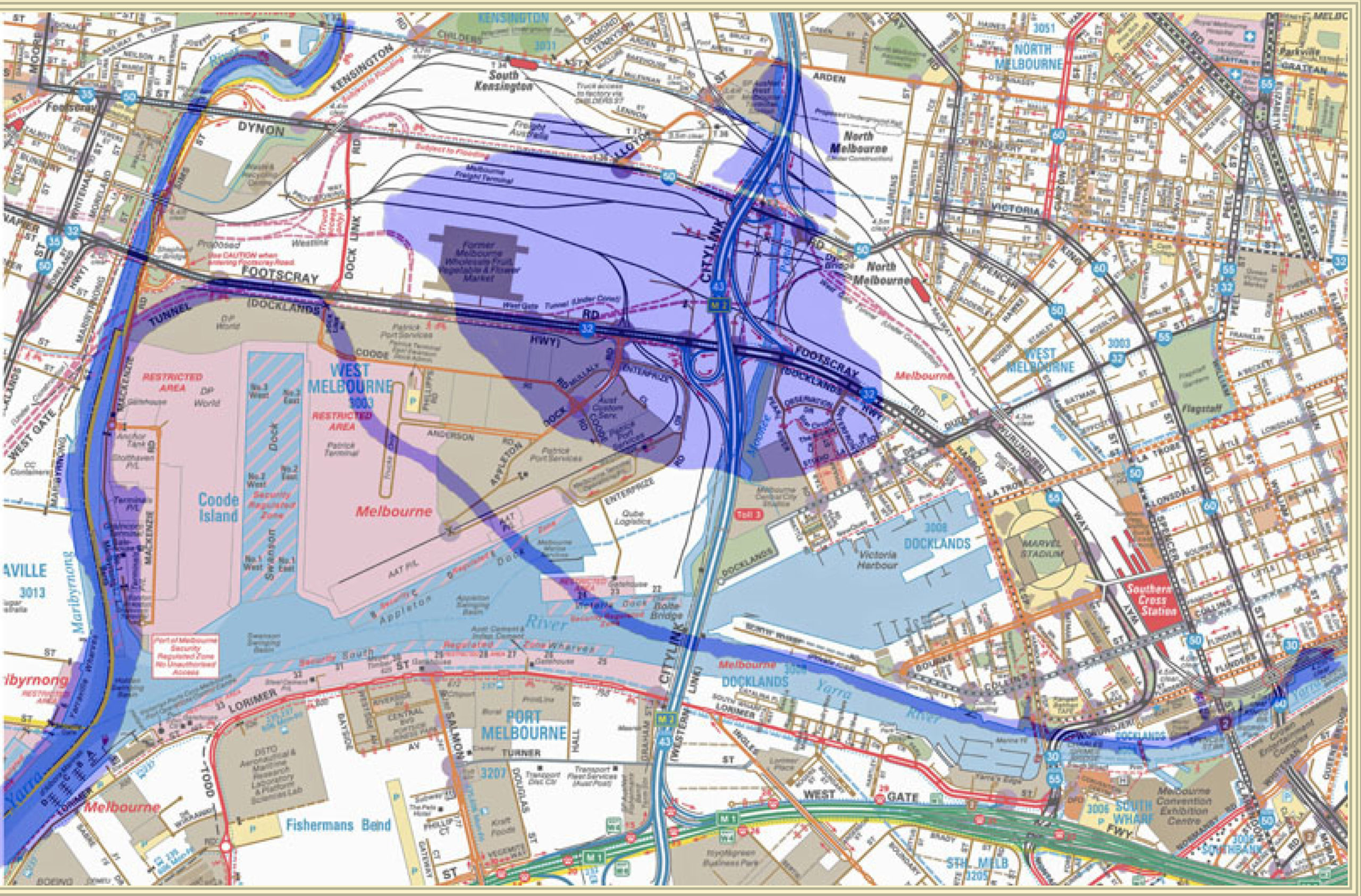
Detail of a Melway map of West Melbourne, 2012 with the saltwater lagoon and the old course of the Yarra River superimposed by David Thompson, 2019. The outline of the lagoon and the Yarra River came from the Hobson’s Bay & River Yarra, Melbourne map, by Thomas Cox, 1866, seen earlier in this exhibition.
Melway plan of West Melbourne, Melway Publishing, 2012.
The Swamp Vanishes
The difficulty of filling or floodproofing the swamp resulted in a large tract of land remaining unused well into the twentieth century.
From the 1850s and throughout the next century, the swamp was slowly drained, dredged or built up in various projects. A railway embankment for the line to Williamstown skirted the swamp in the north in the 1850s, followed by the construction of Swamp Road (later Dynon Rd).
Footscray Road was built in the 1890s. Various authorities, such as the Melbourne City Council, the Harbour Trust and the Railways department tipped waste near the end of Dudley Street.
In the 1950s, the amount of goods handling and storage needs for the railways and new docks and warehouses finally made it an economic proposition to complete the drainage and filling of the swampy areas which still existed.
By 1976 the swamp had vanished, replaced by railway yards and container storage areas, leaving only the Dynon Road Drain and wildlife reserve as a reminder of the large wetland that once provided sustenance for the Kulin nation.
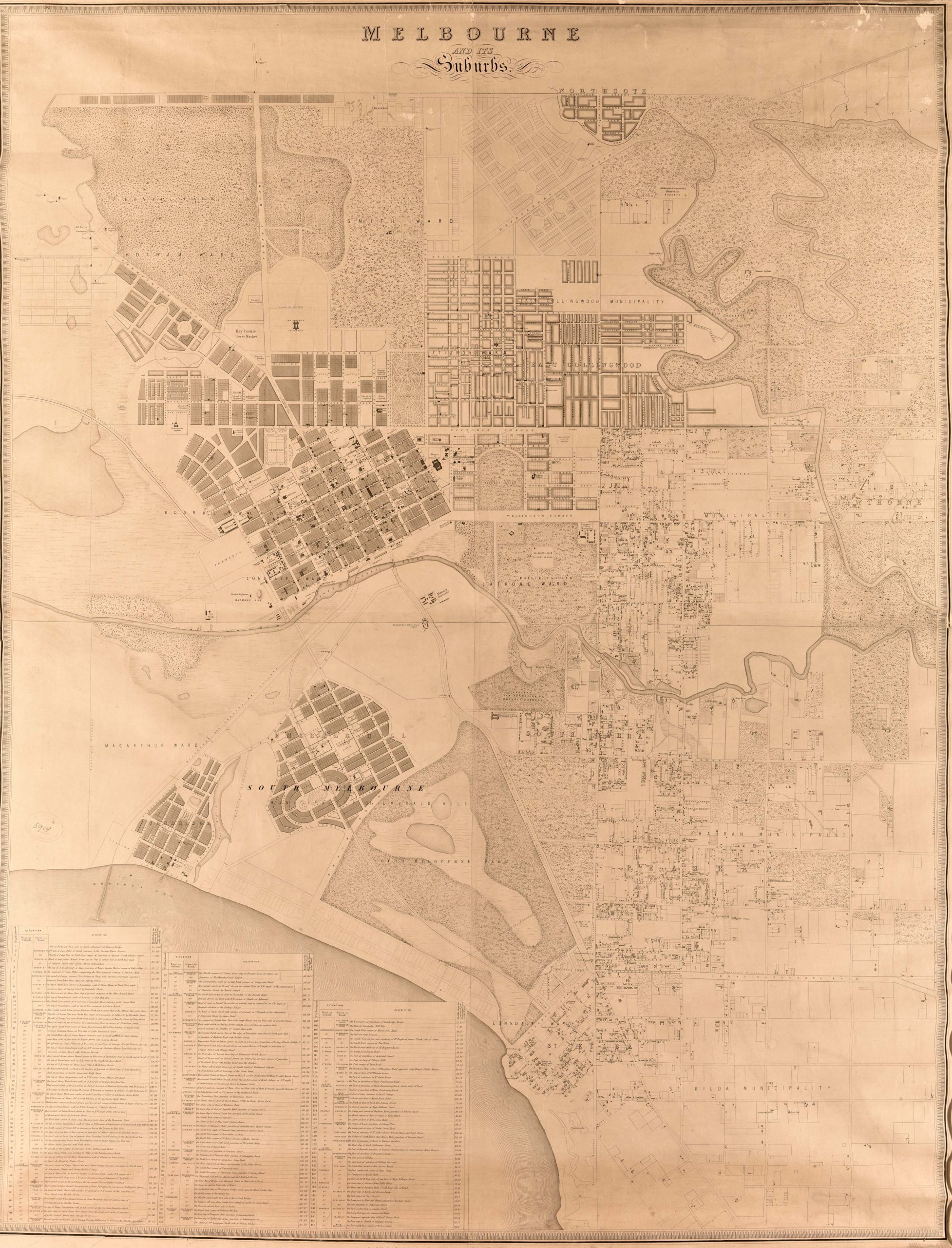
Melbourne and its suburbs
Compiled by James Kearney, draughtsman; engraved by David Tulloch and James D. Brown, 1855.
Royal Historical Society of Victoria Collection.
MNE-GT-43R
For a more detailed view, you can find this map in the State Library collection here: http://handle.slv.vic.gov.au/10381/89107


 239 A'Beckett Street Melbourne, Victoria, 3000
  03 9326 9288
  office@historyvictoria.org.au
  Office & Library: Weekdays 9am-5pm

