Map of Port Phillip
The Port Phillip Association, originally the Geelong and Dutigalla Association, was formed in Tasmania in June 1835, to settle land across Bass Strait in the Colony of New South Wales.
The land had ostensibly been acquired by John Batman from Wurundjeri Woi wurrung elders after he had obtained their marks to a document which became known as “Batman’s Treaty”. The First Nations people had no concept of ceding their territory to the white men. Returning to Tasmania, Batman described his journeyings in Port Phillip to John Helder Wedge, a surveyor and member of the Association.
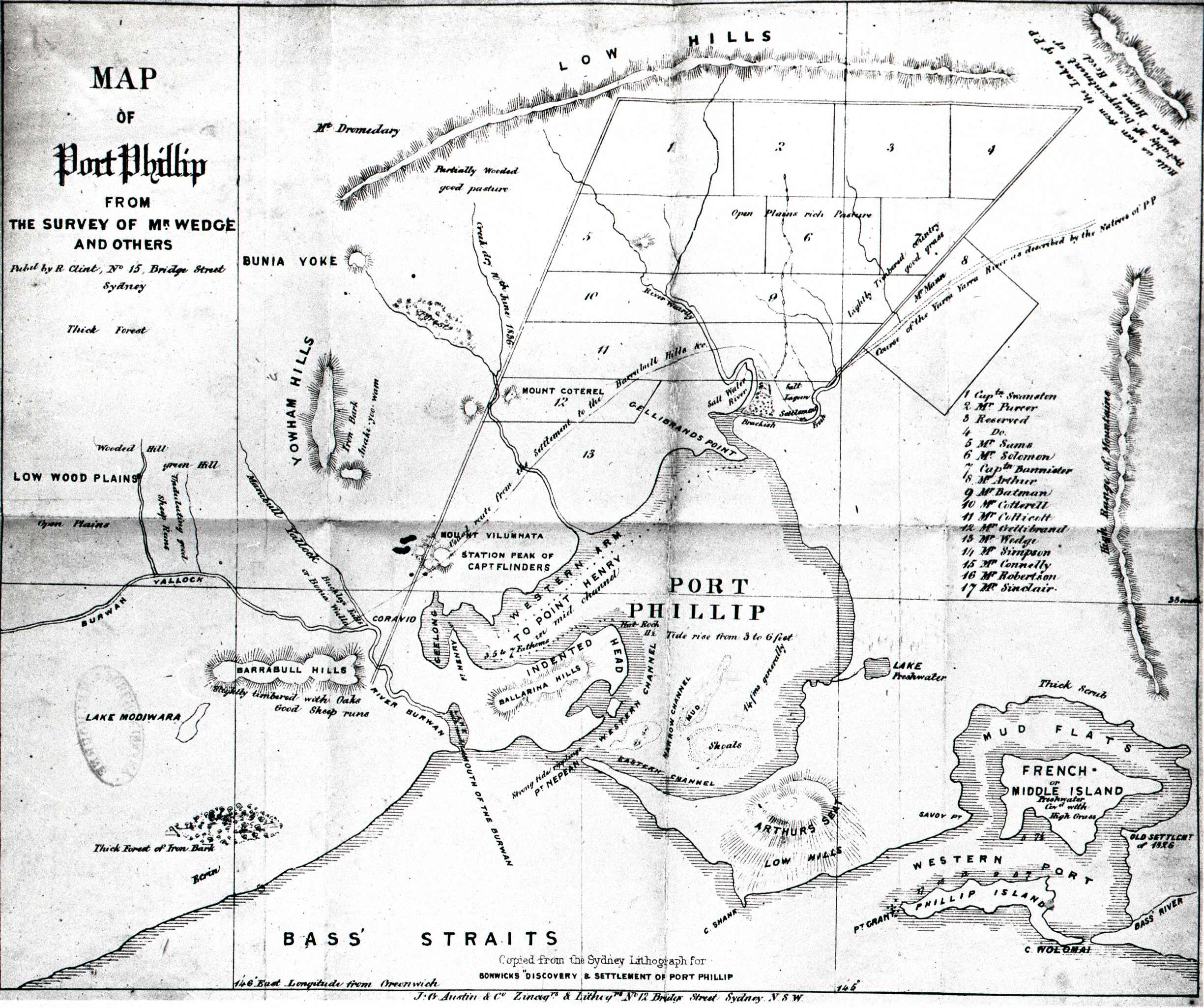
Wedge then prepared a map of Port Phillip, published in 1836, showing the sections allotted to each member of the Association, listed in the centre-right of the map.
The map showed important features for sheep farmers – watercourses; and “open plains, rich pasture”, and “lightly timbered country, good grass”.
It also noted a salt lagoon west of the settlement on the freshwater Yarra Yarra river.
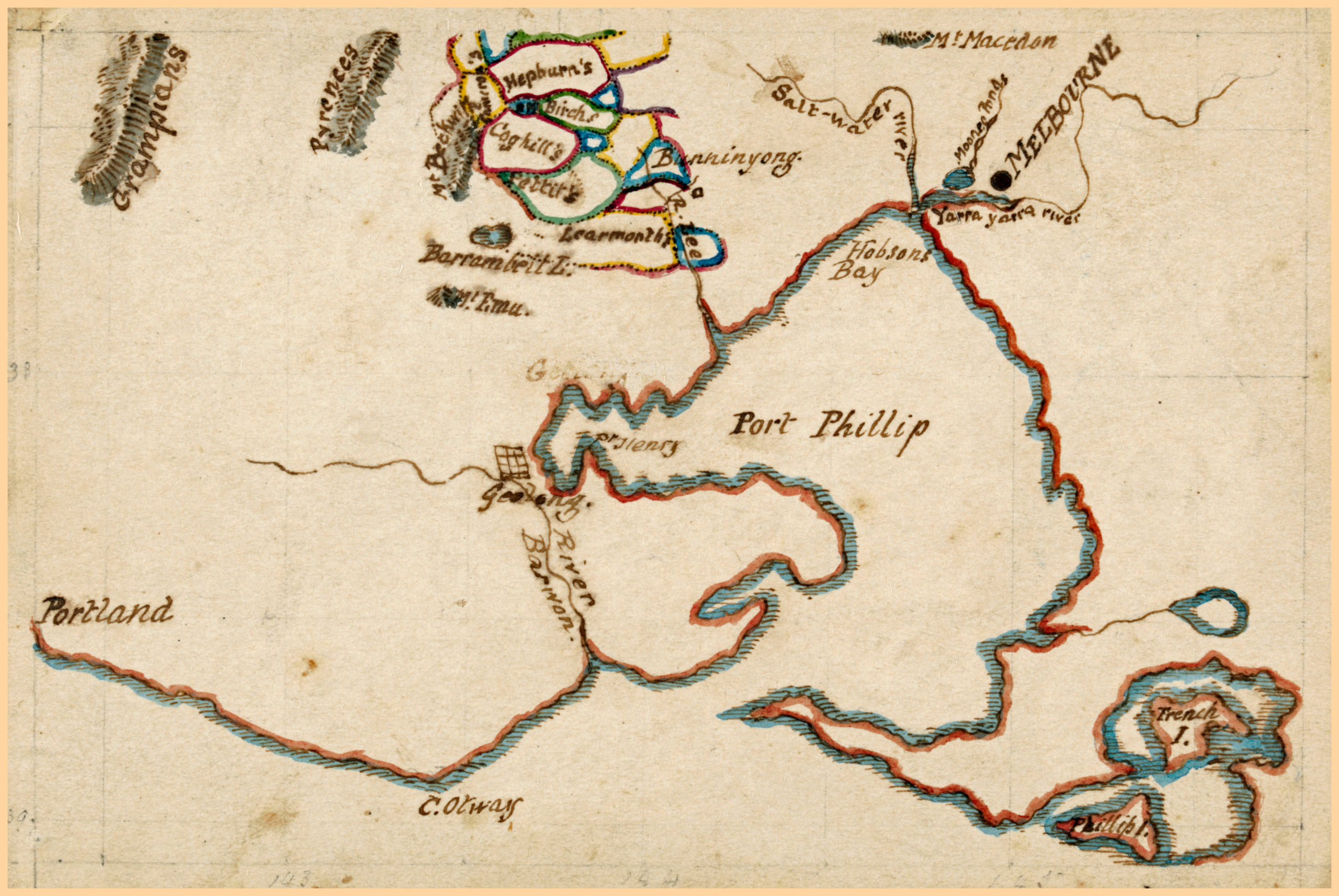
In this map of the Port Phillip District, the saltwater lagoon is shown as the last and largest pond in the Moonee Moonee Chain Ponds.
Map of the Port Philip District, circa 1844-1863. Charles Norton (1826-1872), draughtsman. Courtesy of the State Library Victoria Collection, H88.21/96
On 26 August 1835 the Governor of New South Wales, Sir Richard Bourke, issued a proclamation intended to void Batman’s treaty. This reinforced “terra nullius”, the notion that the land belonged to no one prior to the British Crown taking possession of it. Only the Crown could sell or assign land.
Governor Bourke paid a visit to the Port Phillip District in 1837 and named the settlement Melbourne (previously known variously as Batmania, Bearbrass, Bareport, Bareheep, Barehurp and Bareberp), in honour of the then Prime Minister, Lord Melbourne.
Map of Port Phillip, from the survey of Mr Wedge and Others. Pubd. by R Clint, No 15 Bridge st, Sydney. RHSV Collection


 239 A'Beckett Street Melbourne, Victoria, 3000
  03 9326 9288
  office@historyvictoria.org.au
  Office & Library: Weekdays 9am-5pm

