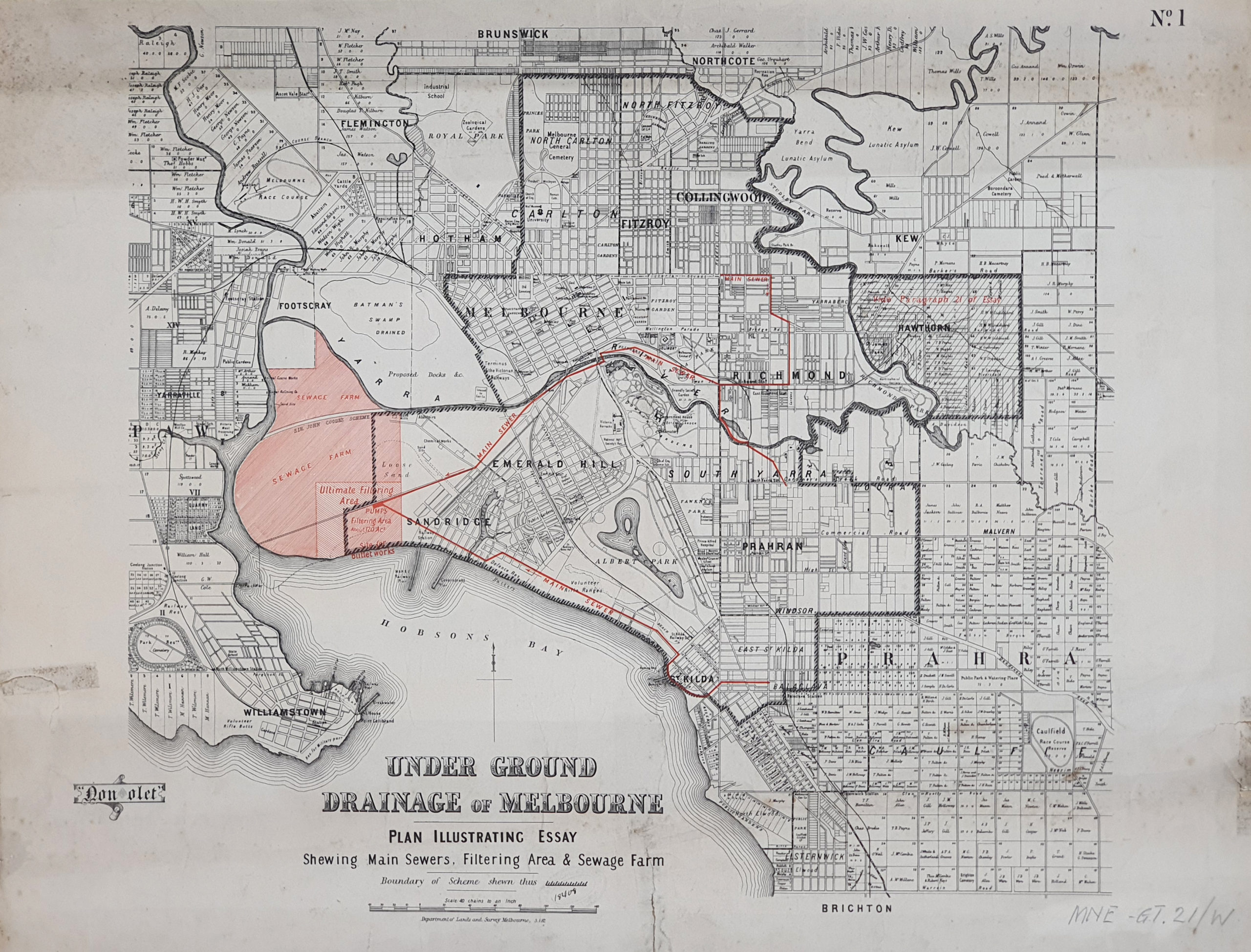
This plan shows a proposal for a sewage farm on what is essentially wasteland south of the Yarra River. The draftsman made an annotation to the bottom left hand corner – “Non olet” – “Doesn’t stink!” Left vacant for many years, Coode Island became a notable bird sanctuary.
Under Ground Drainage of Melbourne, Plan illustrating essay shewing main sewers, filtering area and sewage farm, 1882. Royal Historical Society of Victoria Collection. MNW-GT-21-W
In this 1910 plan, the old course of the Yarra is still shown. A Railway Coal Canal has been excavated and three council desiccators have been constructed on the swamp near Dynon Road (Labelled Footscray Road on the plan). A tidal canal has been constructed along Dynon Road, emptying into the Saltwater (now Maribyrnong) River.
West Melbourne Swamp and portions of Harbor Trust and Railway lands photo lithographed at the Department
By the time of the 1935 map, the old course of the Yarra was slowly being filled in, a process completed in the 1950s. The gasworks was still there, tucked up against an extended Spencer Street Station, Victoria Dock has been expanded.
Detail from Melbourne and Suburbs, compiled at the Department of Lands and Survey, Melbourne, by F.S. Hicke, 1923; revised by R.S. Dunn, 1935, State Library of Victoria Collection

The Age, 10 July 1891, p1


 239 A'Beckett Street Melbourne, Victoria, 3000
  03 9326 9288
  office@historyvictoria.org.au
  Office & Library: Weekdays 9am-5pm

